
New barriers spotted around Crimean Bridge on satellite imagery
Google Maps has updated its satellite imagery of the Crimean Bridge, revealing the defense system Russia has deployed around the Kerch Strait crossing.

 Follow us on Google

The Crimean Bridge (illustrative photo) / © Associated Press / © Associated Press
Google Maps has updated its satellite images of the Crimean Bridge. The new high-resolution images show large-scale protective structures that Russia has installed around the facility.
This was reported by the OSINT channel «Eye of Horus» (Oko Hora), citing the Google Maps satellite imagery.
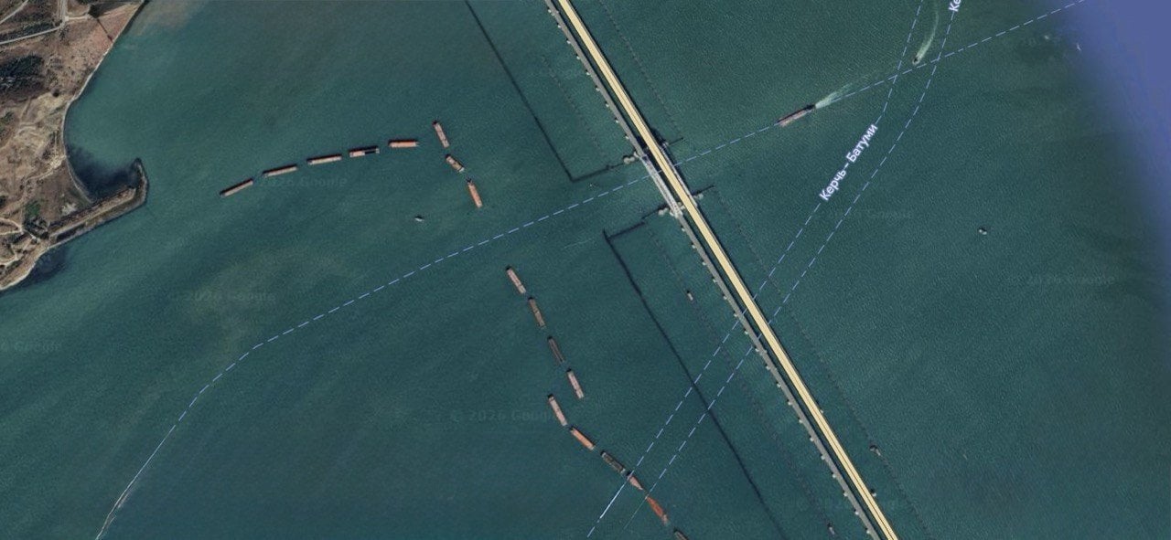
A satellite image of the Crimean Bridge area, showing barges and protective structures around the crossing. / © Google Maps
The photos show the defense system deployed near the Kerch Strait crossing. Specifically, the Russians have placed barges along the approaches to the bridge, and boom defenses as well as anti-sabotage barriers are visible in the water.
Some of the structures are positioned directly next to the shipping channel that runs under the bridge’s arch span.
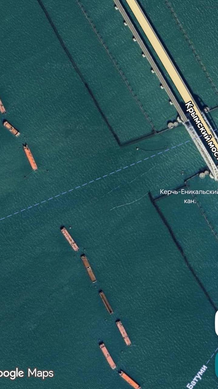
A satellite image of the Crimean Bridge area, showing barges and protective structures around the crossing. / © Google Maps
Russia began more actively installing these protective structures following attacks on the Crimean Bridge and the growing threat of maritime drone strikes.
The Crimean Bridge remains one of the key logistical routes for supplying Russian troops on the temporarily occupied peninsula. For this reason, its defense is one of the top priorities for the Russian Federation.